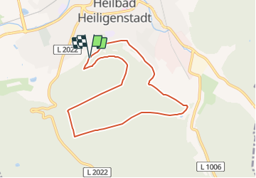
![](/images/other/stat-length.png)
![Randonnée A pied Heilbad Heiligenstadt - Die Ibergrunde - Photo](https://media.geolcdn.com/t/1900/400/408f8191-52dd-4733-8a7c-8090ff022505.jpeg&format=pjpeg&maxdim=2)
Die Ibergrunde
SityTrail - itinéraires balisés pédestres
Tous les sentiers balisés d’Europe GUIDE+
![Longueur](/images/other/stat-length.png)
![Altitude max](https://static1.geolcdn.com/siteimages/upload/files/1508320355ic_sort_altitude_max_24dp.png)
![Dénivelé positif](https://static1.geolcdn.com/siteimages/upload/files/1508320355ic_sort_den_pos_24dp.png)
![Km-Effort](/images/other/stat-length.png)
![Altitude min](https://static1.geolcdn.com/siteimages/upload/files/1508320355ic_sort_altitude_min_24dp.png)
![Dénivelé négatif](https://static1.geolcdn.com/siteimages/upload/files/1508320355ic_sort_den_neg_24dp.png)
![Boucle](https://static1.geolcdn.com/siteimages/upload/files/16400158638029165_repeat_loop_refresh_sync_direction_icon.png)
![A pied](https://static1.geolcdn.com/sitytour/trail-icons/100.png)
2h15
Difficulté : Facile
![Scannez ce code QR pour ouvrir la randonnée dans l'application SityTrail](https://capi.geolives.com/qq0zvz2zws4bq2lad0pu/sitytour/trails/3101733/qr.png?size=200)
Application GPS de randonnée GRATUITE
À propos
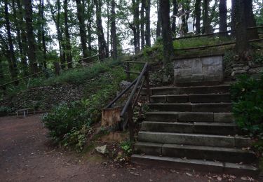
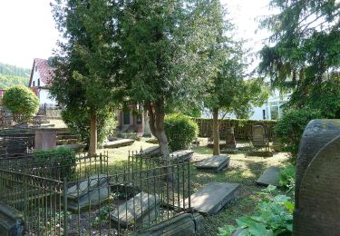
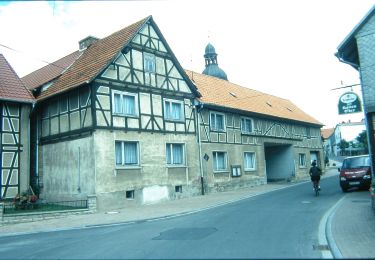
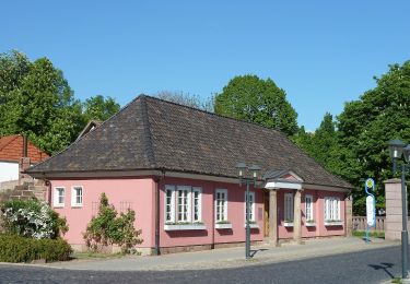
Randonnée A pied de 7,3 km à découvrir à Thuringe, Landkreis Eichsfeld, Heilbad Heiligenstadt. Cette randonnée est proposée par SityTrail - itinéraires balisés pédestres.
Description
Randonnée créée par Stadt Heilbad Heiligenstadt.
Site web: https://www.heilbad-heiligenstadt.de/tourismus-freizeit/aktivitaeten-und-freizeiteinrichtungen/nordic-walking-strecken/
Localisation
Commentaires
Randonnées à proximité
![Randonnée A pied Heilbad Heiligenstadt - Die Heidelbergrunde - Photo](https://media.geolcdn.com/t/375/260/d54794a1-00c5-434d-9208-0968bb150e66.jpeg&format=jpg&maxdim=2)
![A pied A pied](https://static1.geolcdn.com/sitytour/trail-icons/100.png)
A pied
![](/images/other/stat-length.png)
![](https://static1.geolcdn.com/siteimages/upload/files/16400158638029165_repeat_loop_refresh_sync_direction_icon.png)
![Randonnée A pied Heilbad Heiligenstadt - Wanderweg von Heilbad Heiligenstadt zur Kapelle Steinhagen - Photo](https://media.geolcdn.com/t/375/260/1d1c05da-1f3a-4a22-9e17-5580051bc5da.jpeg&format=jpg&maxdim=2)
![A pied A pied](https://static1.geolcdn.com/sitytour/trail-icons/100.png)
A pied
![](/images/other/stat-length.png)
![](https://static1.geolcdn.com/siteimages/upload/files/16400158638029165_repeat_loop_refresh_sync_direction_icon.png)
![Randonnée A pied Uder - Wanderweg von Uder nach Lutter (Grünes X) - Photo](https://media.geolcdn.com/t/375/260/5fd28731-1514-48b5-a34b-0d34447b1aa7.jpeg&format=jpg&maxdim=2)
![A pied A pied](https://static1.geolcdn.com/sitytour/trail-icons/100.png)
A pied
![](/images/other/stat-length.png)
![](https://static1.geolcdn.com/siteimages/upload/files/16400158638029165_repeat_loop_refresh_sync_direction_icon.png)
![Randonnée A pied Heilbad Heiligenstadt - Elisabethhöhe Rundwanderweg (Grüner Balken) - Photo](https://media.geolcdn.com/t/375/260/408f8191-52dd-4733-8a7c-8090ff022505.jpeg&format=jpg&maxdim=2)
![A pied A pied](https://static1.geolcdn.com/sitytour/trail-icons/100.png)
A pied
![](/images/other/stat-length.png)
![](https://static1.geolcdn.com/siteimages/upload/files/16400158638029165_repeat_loop_refresh_sync_direction_icon.png)
![Randonnée A pied Heilbad Heiligenstadt - Wanderweg von Heilbad Heiligenstadt nach Uder (Roter Punkt) - Photo](https://media.geolcdn.com/t/375/260/408f8191-52dd-4733-8a7c-8090ff022505.jpeg&format=jpg&maxdim=2)
![A pied A pied](https://static1.geolcdn.com/sitytour/trail-icons/100.png)
A pied
![](/images/other/stat-length.png)
![](https://static1.geolcdn.com/siteimages/upload/files/16400158638029165_repeat_loop_refresh_sync_direction_icon.png)
![Randonnée A pied Heilbad Heiligenstadt - Wanderweg nach Effelder (Roter Balken) - Photo](https://media.geolcdn.com/t/375/260/b6148d4c-aa26-4cf1-b368-6a4ea9996676.jpeg&format=jpg&maxdim=2)
![A pied A pied](https://static1.geolcdn.com/sitytour/trail-icons/100.png)
A pied
![](/images/other/stat-length.png)
![](https://static1.geolcdn.com/siteimages/upload/files/16400158638029165_repeat_loop_refresh_sync_direction_icon.png)
![Randonnée A pied Heilbad Heiligenstadt - Iberg Rundwanderweg (Gelber Punkt) - Photo](https://media.geolcdn.com/t/375/260/408f8191-52dd-4733-8a7c-8090ff022505.jpeg&format=jpg&maxdim=2)
![A pied A pied](https://static1.geolcdn.com/sitytour/trail-icons/100.png)
A pied
![](/images/other/stat-length.png)
![](https://static1.geolcdn.com/siteimages/upload/files/16400158638029165_repeat_loop_refresh_sync_direction_icon.png)
![Randonnée A pied Heilbad Heiligenstadt - Iberg Rundwanderweg (Gelber Balken) - Photo](https://media.geolcdn.com/t/375/260/408f8191-52dd-4733-8a7c-8090ff022505.jpeg&format=jpg&maxdim=2)
![A pied A pied](https://static1.geolcdn.com/sitytour/trail-icons/100.png)
A pied
![](/images/other/stat-length.png)
![](https://static1.geolcdn.com/siteimages/upload/files/16400158638029165_repeat_loop_refresh_sync_direction_icon.png)
![Randonnée A pied Heilbad Heiligenstadt - Dün Rundwanderweg (Grüner Balken) - Photo](https://media.geolcdn.com/t/375/260/68e2d449-adf3-464d-b570-1d62214079d5.jpeg&format=jpg&maxdim=2)
![A pied A pied](https://static1.geolcdn.com/sitytour/trail-icons/100.png)
A pied
![](/images/other/stat-length.png)
![](https://static1.geolcdn.com/siteimages/upload/files/16400158638029165_repeat_loop_refresh_sync_direction_icon.png)